Helping today ![]() Securing tommorow
Securing tommorow
Wajir County is located in northeastern Kenya. It borders Mandera to the north, Somalia to the east, Garissa County to the south, Isiolo and Marsabit Counties to the west, and Ethiopia to the North West. It covers an area of 56,685.8 Km2.
The County is subdivided into six sub-counties (Wajir East, Wajir West, Wajir North, Wajir South, Tarbaj and Eldas). The county has a population of 781,263 (Vol. 1 KPHC 2019), with 415,374 of the population being male, 365,840 being female and 49 being intersex.
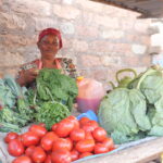
Some major economic activities of Wajir County include Natural resources as wildlife, livestock, water, pasture, minerals (limestone, sand & stones), wind and solar energy. The county also has tourist attractions like Wajir Museum, Wagalla Massacre
Site, Orpahey Wells, British and Italian War Bunkers, Old Court House, Yahut Dam, Old Court House.Further, the communities in Wajir county, practice economic activities like Livestock Keeping of animals like camels, goats, cows & sheep and Trading, general Businesses. Wajir has potential minerals like Gypsum, Limestone, Sillimanite, Wolastonite, Kyanite, and Garnet. 2016 data places WajirCounty’s poverty index at 41.3%